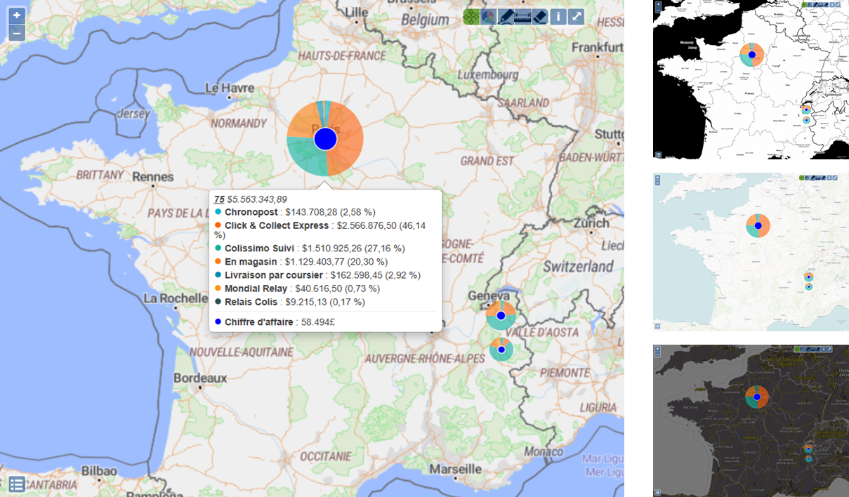
Online Map
OpenStreetMap
OpenStreetMap becomes even more customizable, with the option of choosing different background map providers or using a local server (USGS, …)

Offline Map
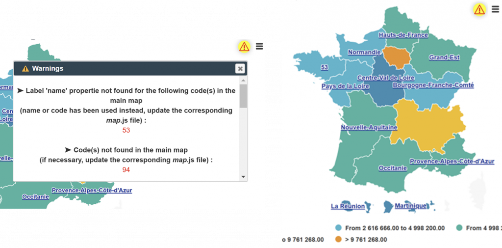
Improvements
• Importing customized maps is simplified, with no need to manage configuration files!
• An alert popup is now automatically displayed to indicate incorrect codes and other inconsistencies in maps and/or data, while allowing the map to be displayed with valid data.
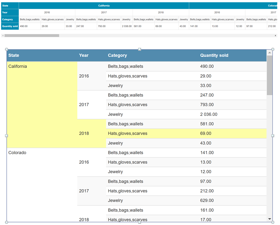
Merging cells
A frequently-requested feature: you can now merge cells in your horizontal and vertical scrollable tables.
A clearer, more legible display, for better reading of your data, even in complex tables!
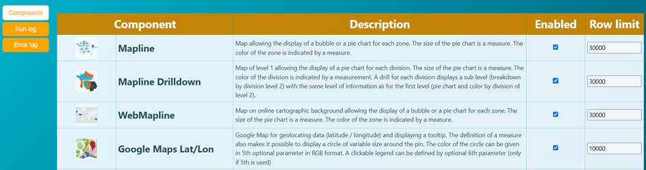
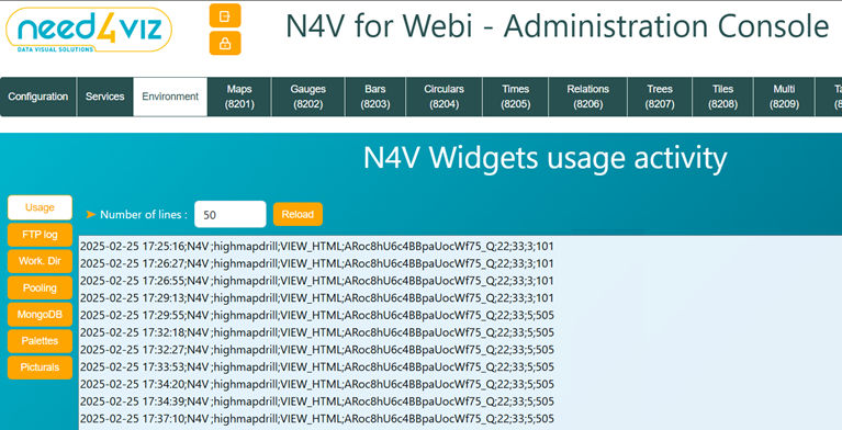
New N4V Administration console
• Console security (password).
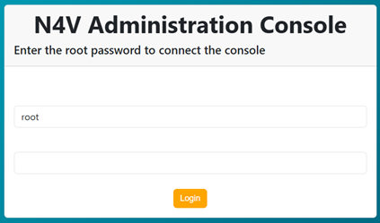
• Management of components to be displayed in Webi + line limits
• Management of logs MongoDB database, SFTP pools…
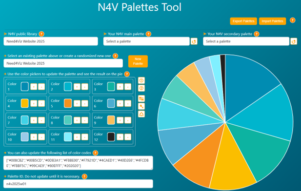
• Interactive management of color palettes and picturals in N4V.
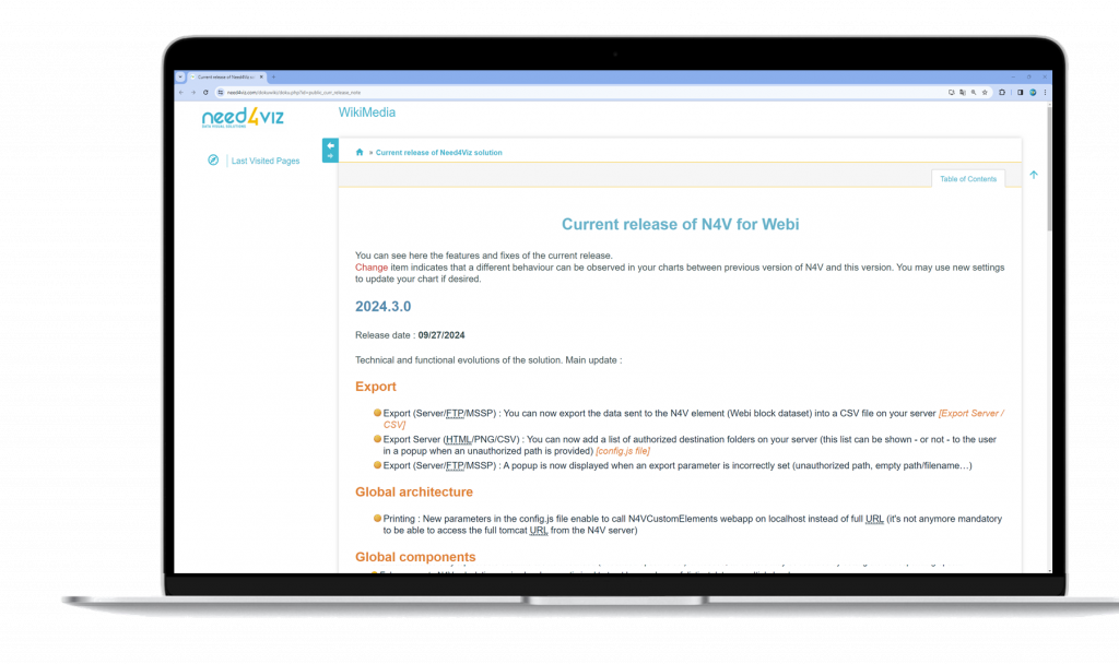
See Wiki for full report
2 major releases in 2025